Search for all NISAR Data Products
Vertex
Vertex is ASF’s web-based data search interface. It is optimized for searching NASA’s SAR holdings, including NISAR. Because search parameters for SAR differ from other types of Earth observation data, it can be helpful to use a search platform tailored specifically for SAR datasets.
1. Search for NISAR data
Navigate to Vertex and set the Search Type to Geographic Search and select NISAR from the Dataset menu. Press Search to explore search results.
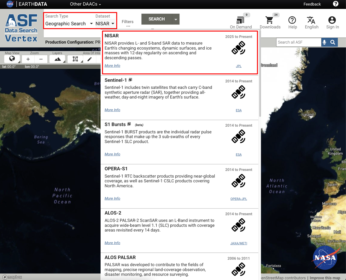
Figure 1:Click on the Dataset field and select NISAR from the drop-down menu to search for NISAR products.
Antarctica
NISAR has great coverage over Antarctica. Users interested in this area may find it helpful to use the Antarctic map projection in Vertex, which renders acquisition footprints at high latitudes much better than the default global view.
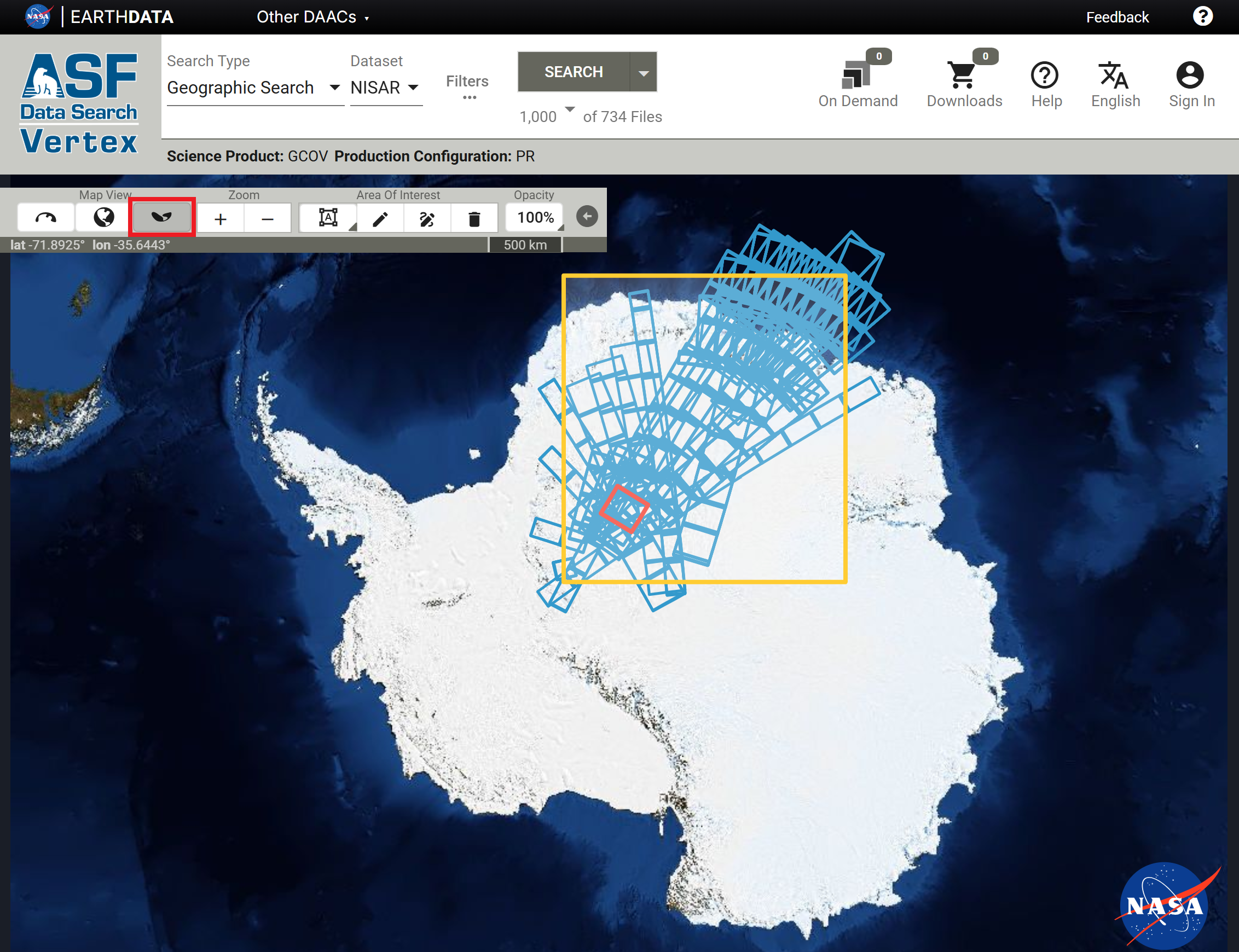
Figure 2:Click the Antarctic map projection button in the Map View section of the Vertex map toolbar to set the map to a south polar stereographic projection.
Note that the Layers button in the toolbar is not available when using a polar map view, as only one basemap layer is available for each polar view.
2. Filter for desired products
Geographic Extent
To search for a specific geographic region, click on the left-most Area of Interest button to choose to draw a point, line, polygon, box, circle, or to upload a geospatial file.
Select a drawing mode to draw a region of interest on the map, then press Search to update the search results for the new region of interest.
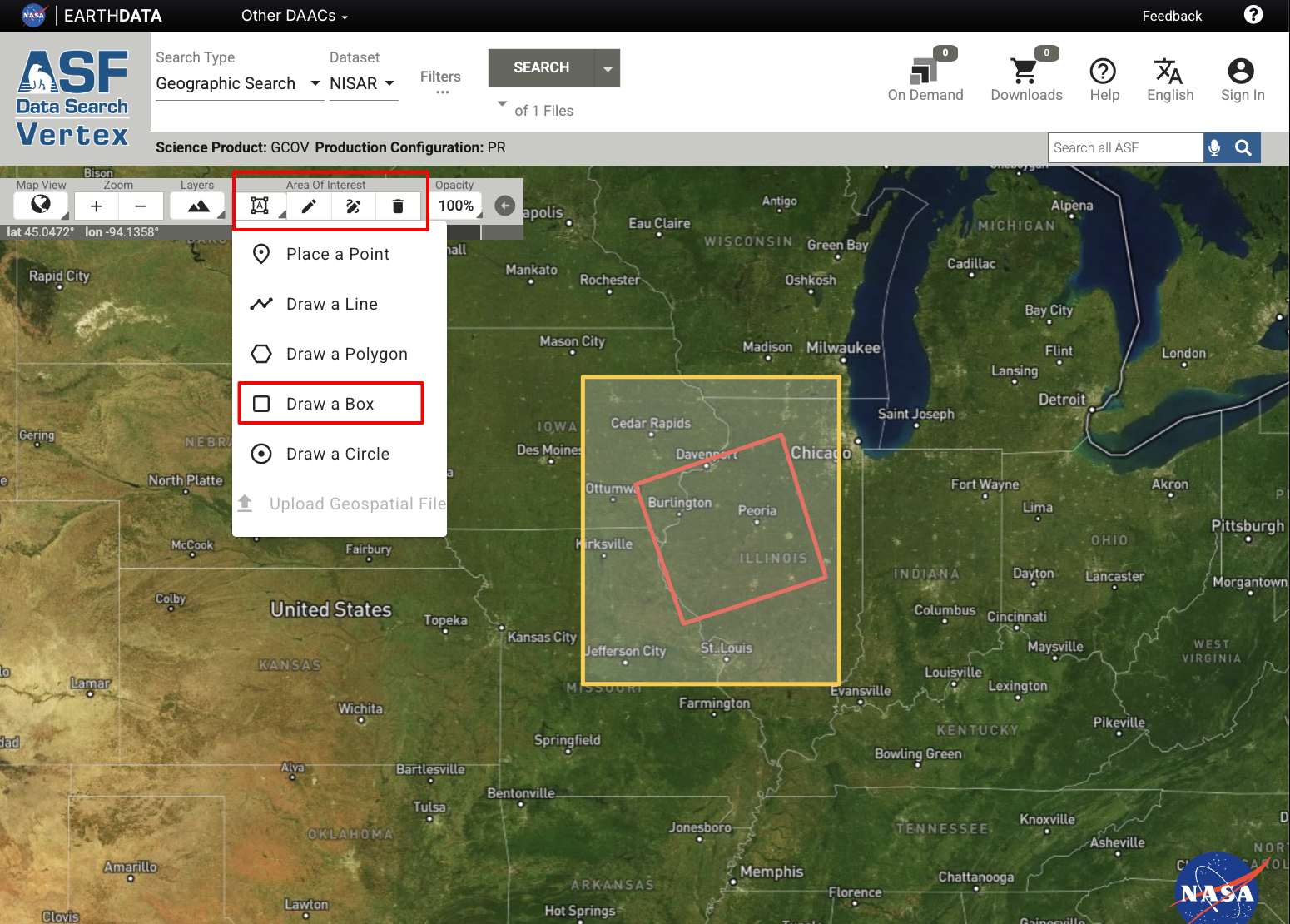
Figure 3:Choose a shape and draw an area of interest for a geographic search.
Take care when drawing an AOI while in the Antarctic Map View. Rectangular AOIs drawn over the South Pole can sometimes be translated into an unexpected polygon, resulting in either no results or many more (orders of magnitude) results than expected. If this occurs, try drawing an AOI to one side or the other of the pole.
Date Range
To search for products in a specific date range, click the Filters button to open the Search Filters panel and specify a start and end date in the Date Filters section. On larger screens, the date range filter will be displayed directly in the top search bar.
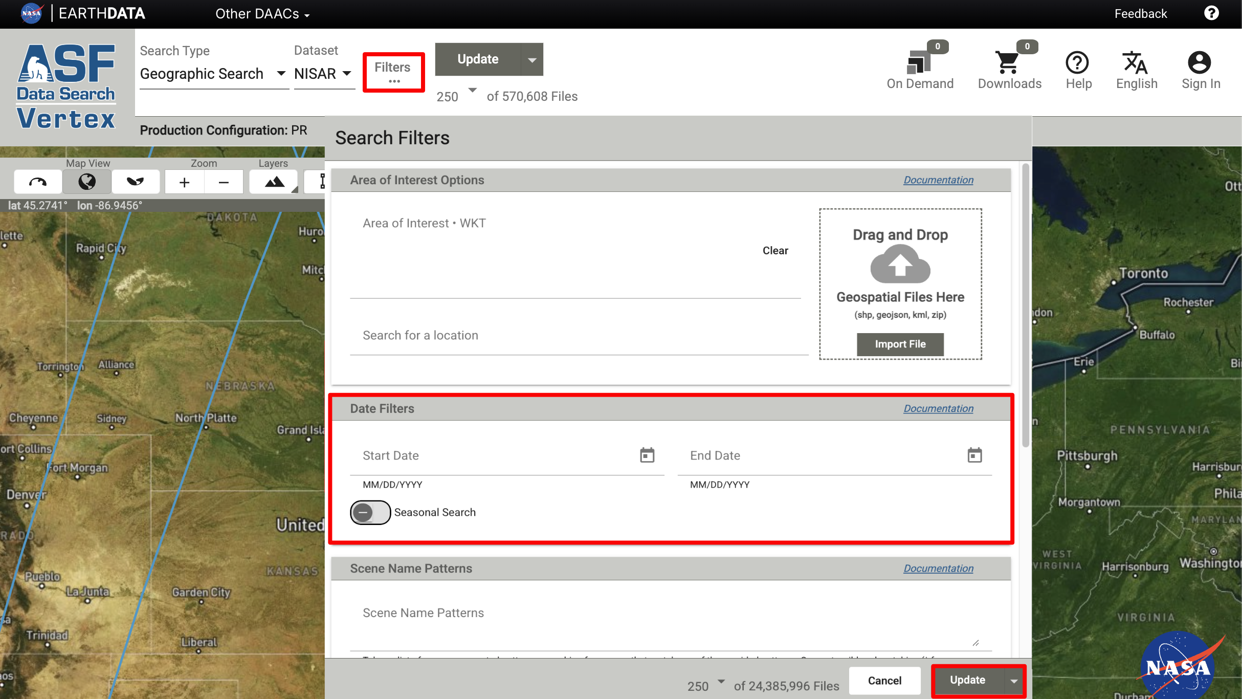
Figure 4:Click the Filters button to open the Search Filters panel and enter a date range.
NISAR Filters
NISAR-specific filters are available to more precisely search for NISAR data products. Refer to the Vertex Getting Started User Guide for a comprehensive list of filters and search options.
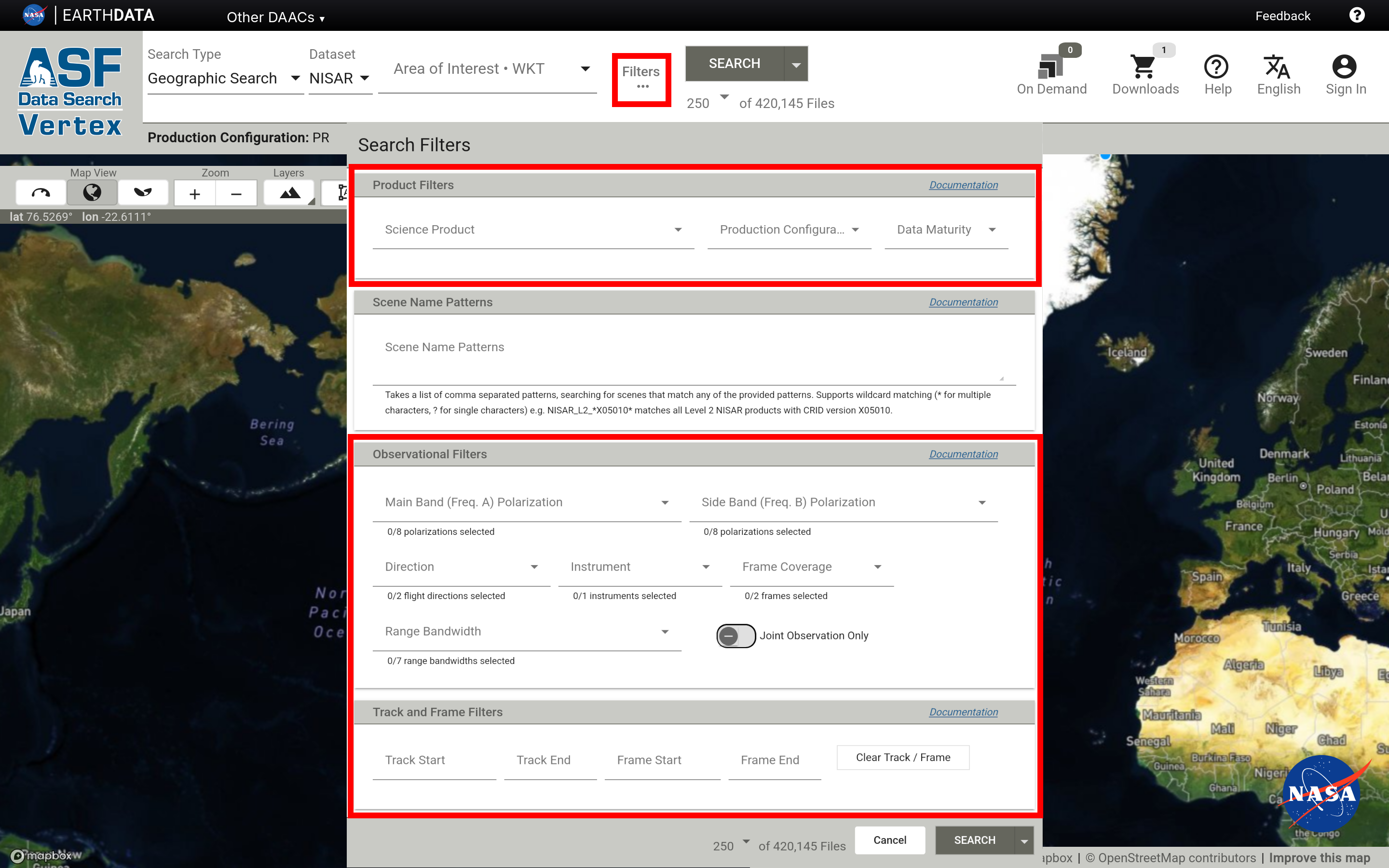
Figure 5:NISAR-specific filters in Vertex.
Product Filters are listed in Table 1. Science Products are organized by product level, and multiple selections are allowed. For a complete list of NISAR products, including detailed descriptions and specifications, refer to Data Products Overview.
Table 1:Product Filters for NISAR Products
| Product Filters | Description |
|---|---|
| Science Product | Specific product type, grouped by product level. Multiple selections allowed. |
| Product Configuration | Specific processing pipelines, including Production and Urgent Response. Multiple selections allowed. |
| Data Maturity | Specific product validation/calibration status between beta and provisional data. Multiple selections allowed. |
Observational Filters allow users to refine search results by polarization, direction, instrument, frame coverage, and/or range bandwidth, as described in Table 2. For information about NISAR bands, frequencies, and polarization, see NISAR Instrumentation. Note that only L-band data are available through Vertex. S-band data are provided through ISRO’s Bhoonidhi.
Table 2:Observational Filters for NISAR Products
| Observational Filters | Description |
|---|---|
| Main Band Polarization | Frequency A polarizations. Multiple selections allowed. |
| Side Band Polarization | Frequency B polarizations. Multiple selections allowed. |
| Direction | Orbit direction (ascending, descending). |
| Instrument | Only L-Band SAR is currently available. |
| Frame Coverage | Full or Partial frame coverage. |
| Range Bandwidth | Range bandwidth in MHz. Multiple selections allowed. |
| Joint Observation Only | Toggle on to restrict search to acquisitions with simultaneous L- and S-Band data collection. |
Users can also search by Track and Frame. Note that “Track” is also known as “Path” or “Relative Orbit” for other satellite missions, such as Sentinel-1. Searching for a specific track and frame will return scenes that align consistently over a specific area. The NISAR track-frame map for available NISAR data is available on the NISAR Mission website.
3. Download data
Data are free and available to download through Vertex. Once the desired scene is selected, a list of files will appear on the right-hand side of the screen (or below the scene details on a narrow browser window).
Download a HDF5 file
Under the Science Data dropdown menu, click the download icon circled in the figure below to save to your computer. You will be prompted to sign in with your Earthdata Login (EDL) account if you have not already. To learn more about HDF5 files, see What is HDF5?.
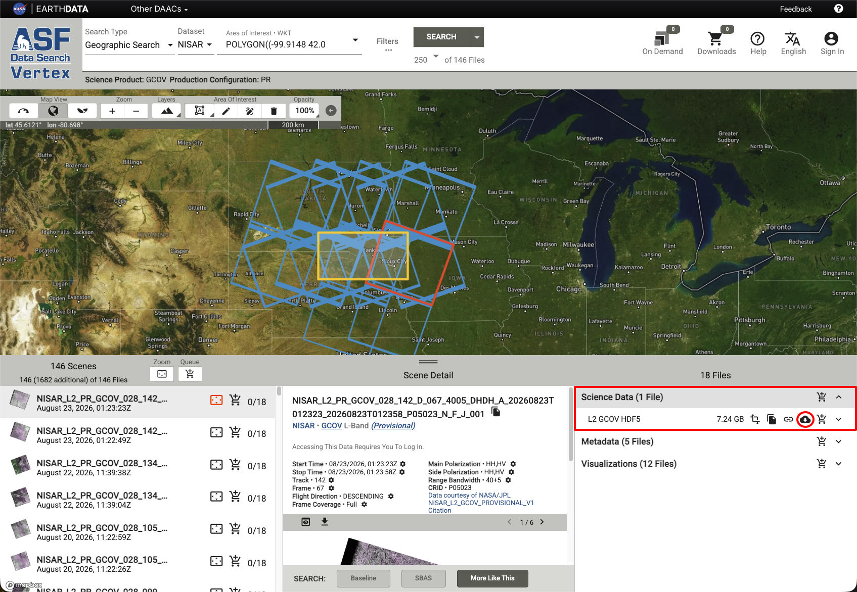
Figure 6:All product files associated with a GCOV product. The HDF5 file, listed first, contains the science data and imagery, and can be downloaded directly by clicking the download icon, circled in red.
Subset Geocoded Products with the GDAL Snippet Exporter
GDAL is a command-line interface (CLI) utility and library that enables the transformation of geographic data. The GDAL snippet exporter allows generating GDAL CLI snippets to extract datasets as a GeoTIFF, spatially subset, or reproject all geocoded (Level 1 and Level 2) NISAR HDF5 products without downloading the entire HDF5 file.
Users can generate a GDAL CLI code snippet using the simple dataset extraction option to download a single dataset or the detailed dataset extraction option to reproject and/or spatially subset before downloading. To learn more about the use of GDAL with NISAR data in general, visit the NISAR Data User Guide page on GDAL.
The Vertex GDAL snippet export generates CLI snippets which stream products directly from NASA’s Earthdata Cloud (EDC) without downloading them first. Ensure that GDAL is installed and you have a .netrc file with your EDL credentials configured before running output GDAL CLI code snippets.
Simple Dataset Extraction to GeoTiff
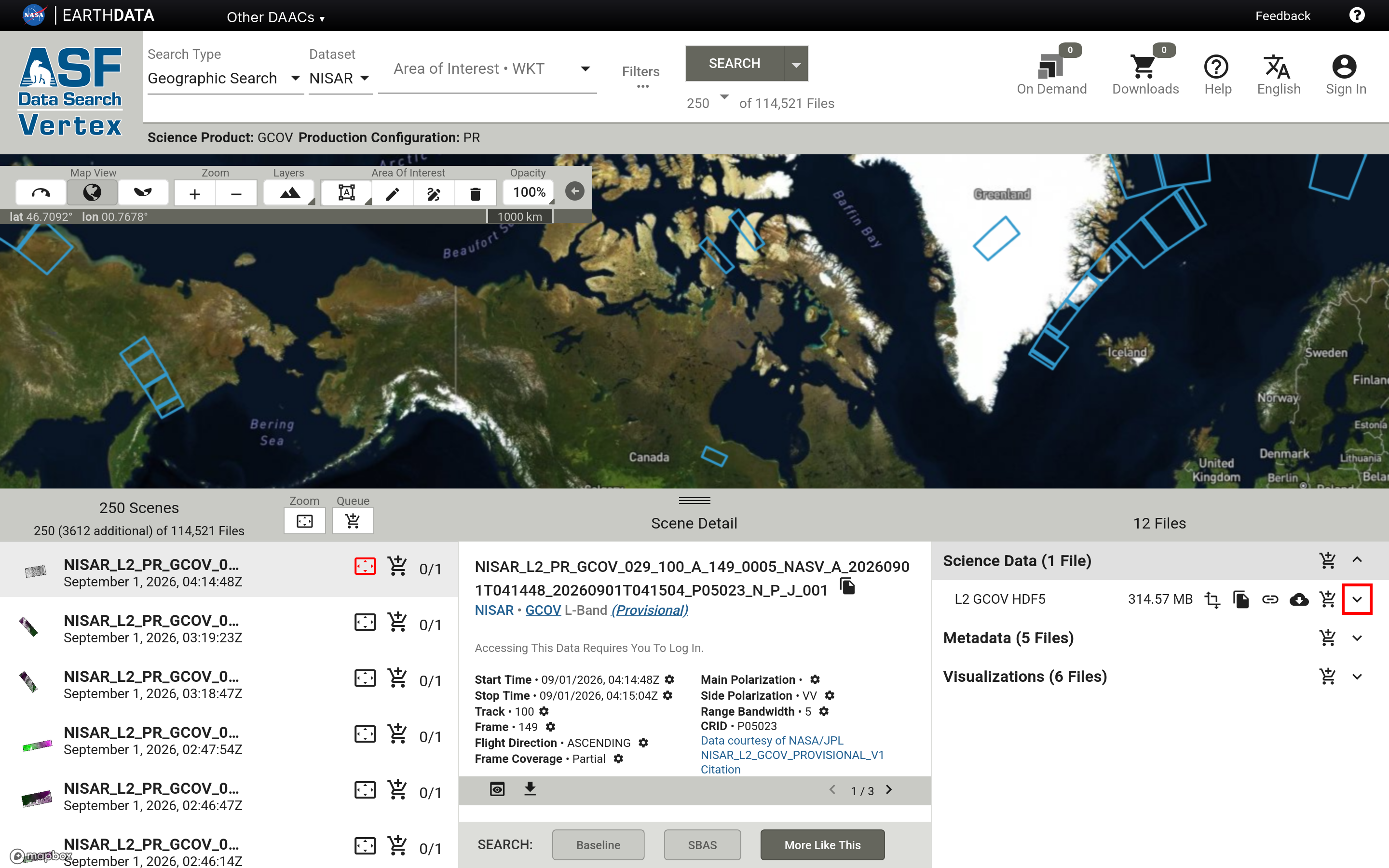
Dataset extraction to GeoTiff can be performed using the simplified GDAL snippet dropdown. To open the GDAL snippet dropdown, click the arrow button on any supported HDF5 file (GCOV, GOFF, GSLC, GUNW or SME2) in the scene file list.
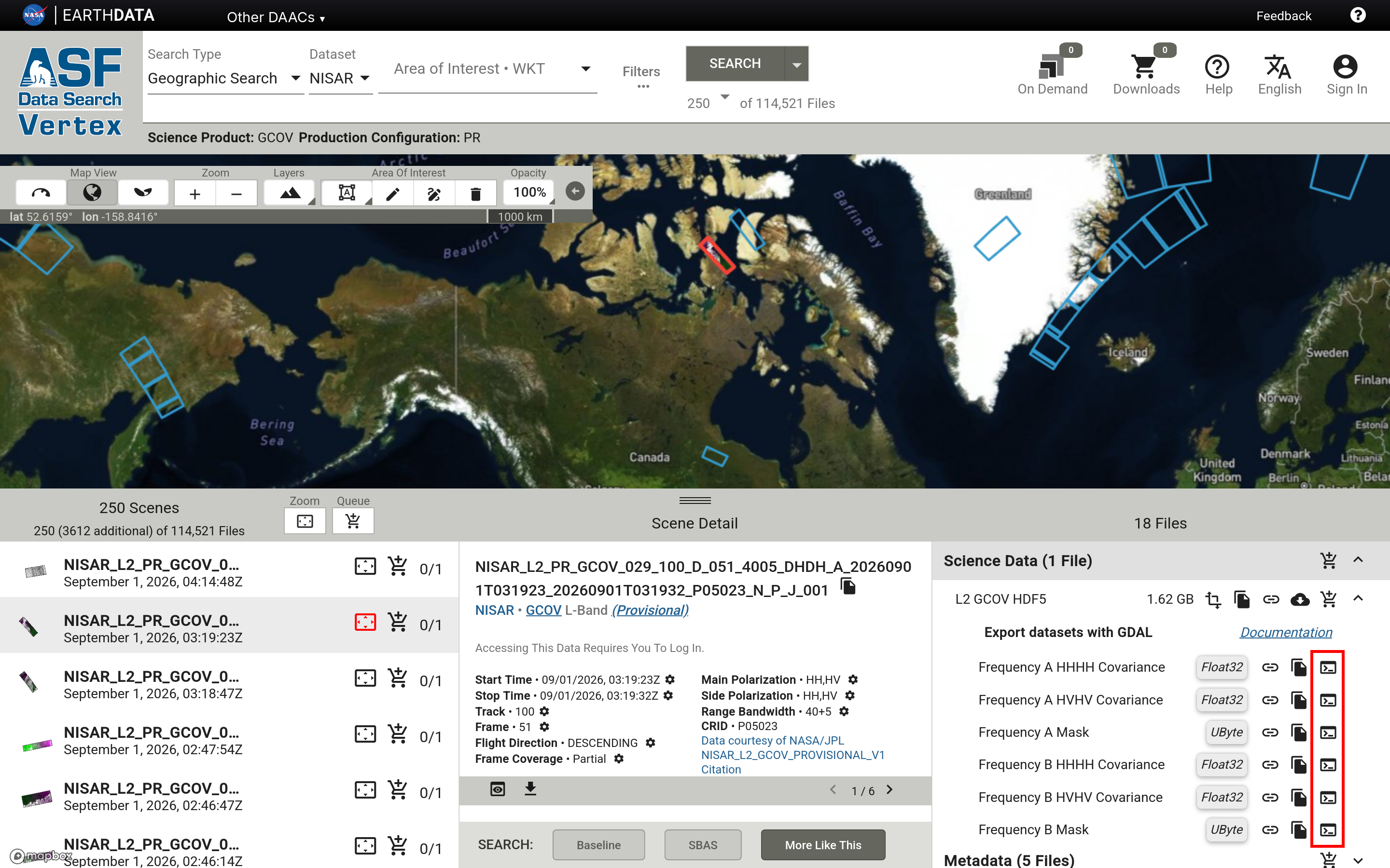
Then, click on the terminal icon next to your desired dataset to copy the GDAL CLI snippet corresponding to that dataset.
Detailed GDAL Snippet Generation
Spatial subsetting, reprojection, and more can be achieved through the GDAL snippet exporter dialog. To open the GDAL snippet dialog, click the transformation icon on any supported HDF5 file in the scene file list.
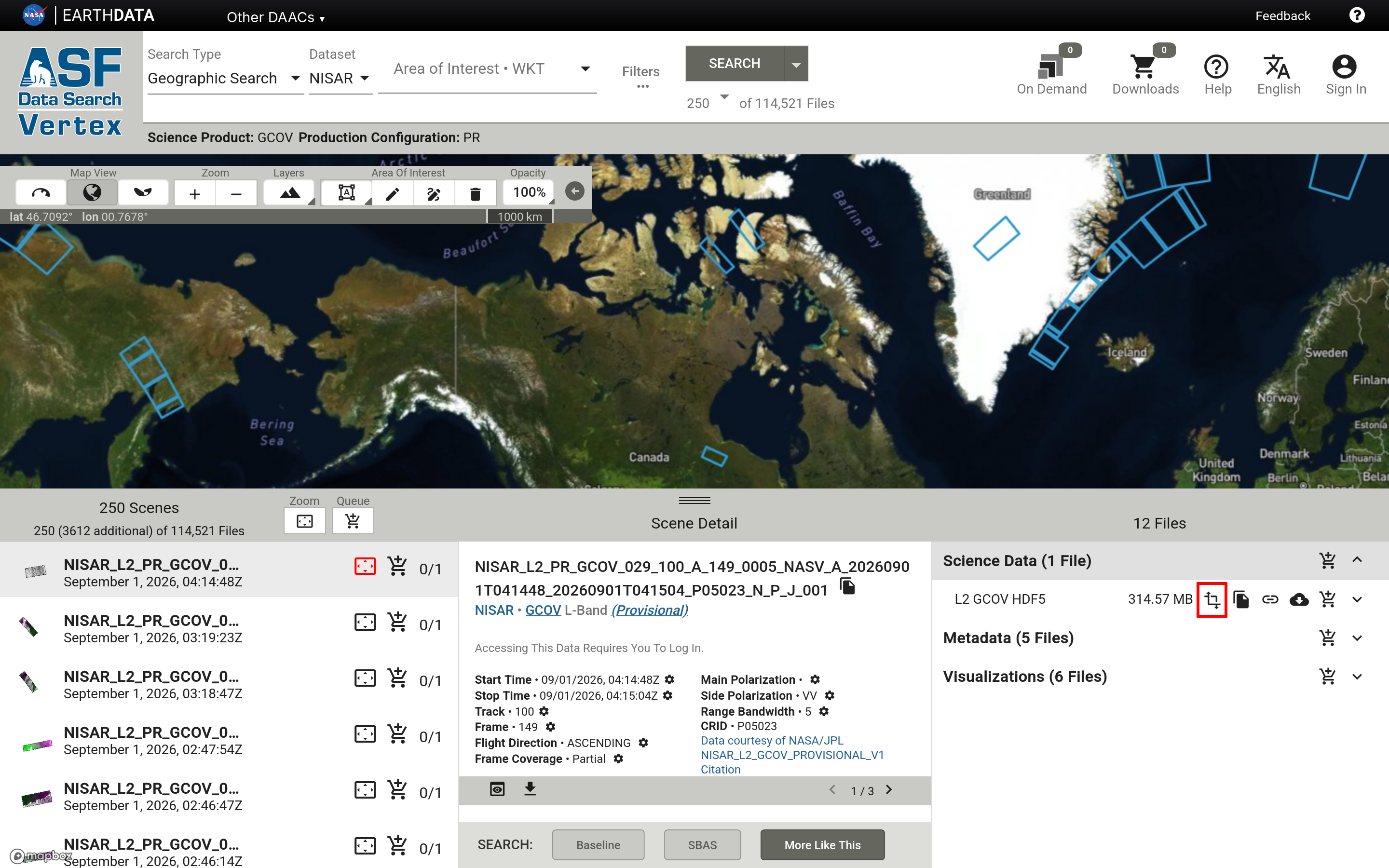
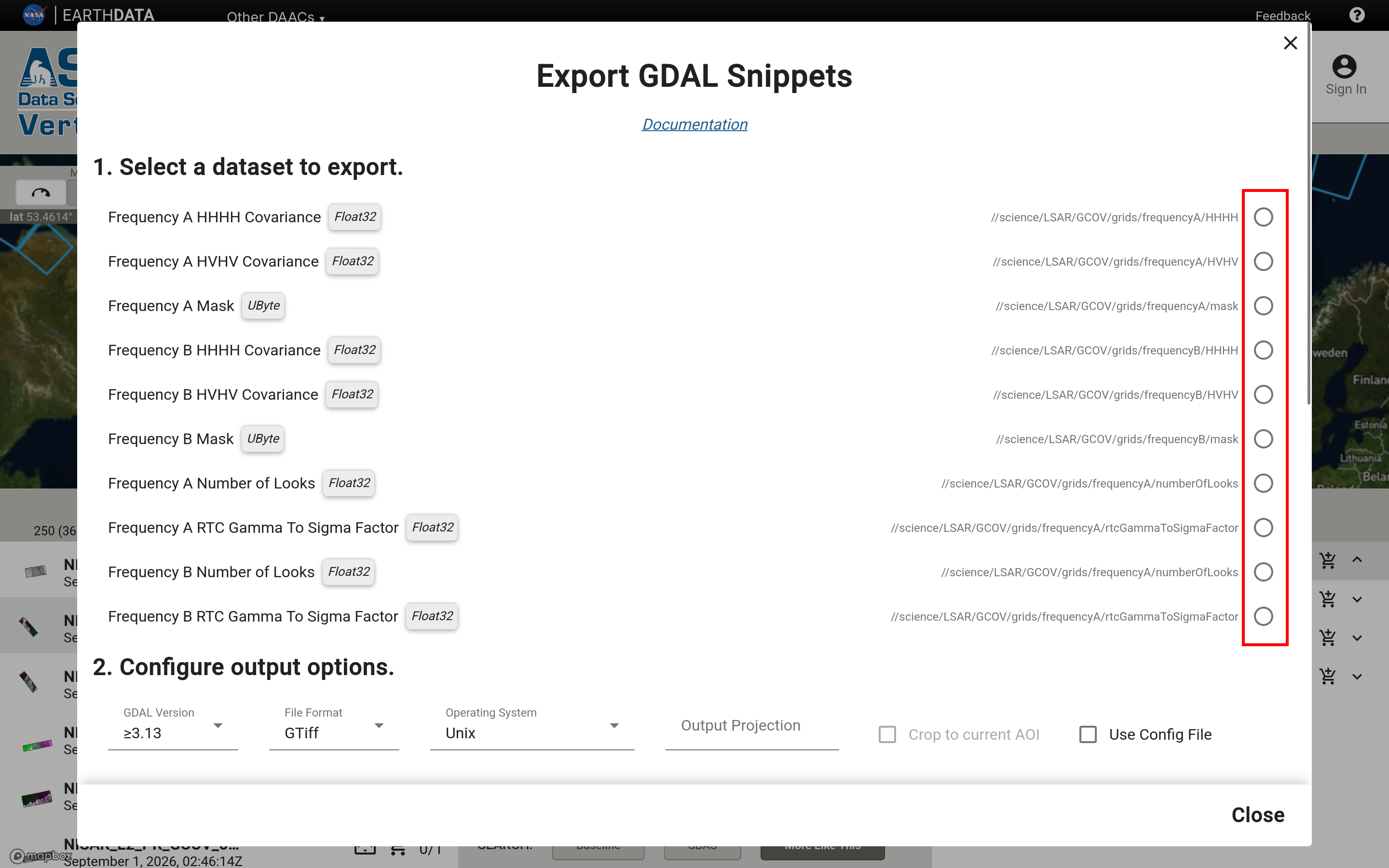
Then, select a dataset in the GDAL snippet dialog.
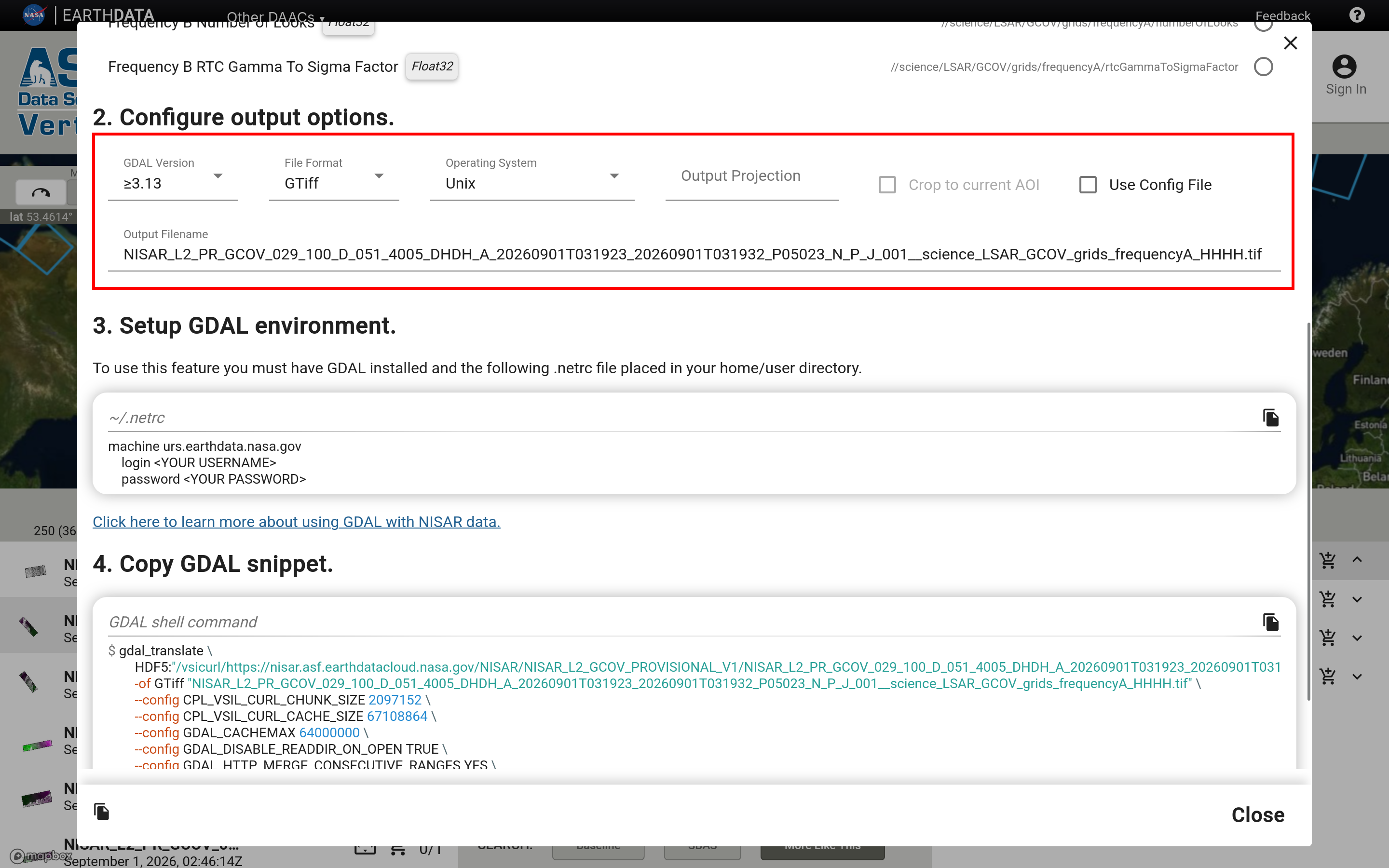
To perform a spatial subsetting operation, ensure you have an area of interest selected on the map view, then check the “Crop to current AOI” box. To perform reprojection enter a EPSG code (ie: EPSG:3857) or WGS84 into the “Output Projection” box.
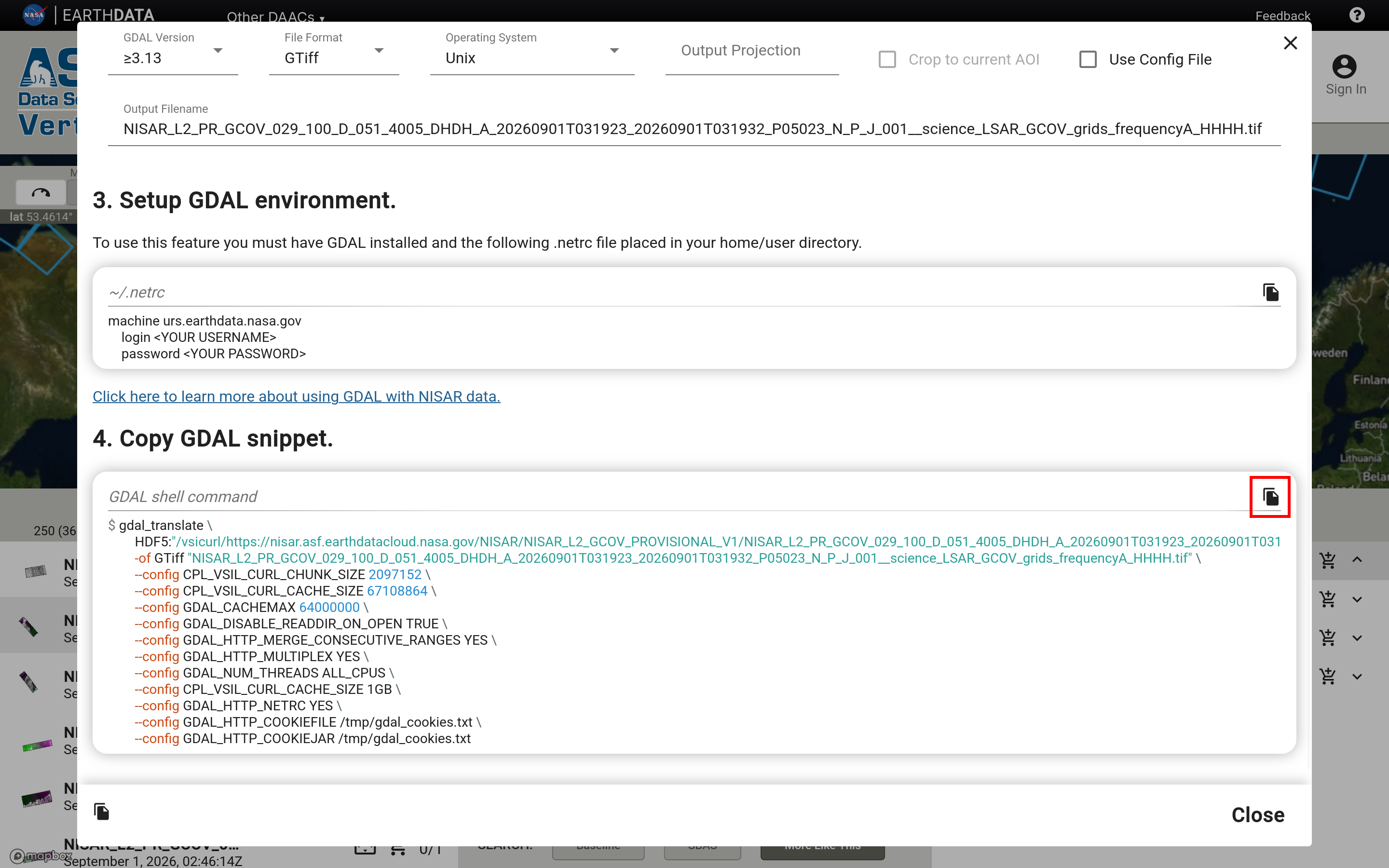
Once you have configured the output options, copy the final output snippet by clicking the copy icon above the “GDAL shell command” code block.
Running GDAL Snippets
To run GDAL snippets on Windows, open the OSGeo4W shell and paste the command into the shell. If asked if you are sure you want to paste your clipboard into the shell, click yes. Then, hit enter to run the command.
To run GDAL snippets on Unix open your system shell or terminal, paste the command into the shell, and hit enter.
Urgent Response Products
Urgent Response (UR) products can be found by setting the Product Configuration filter to Urgent Response. Refer to Urgent Response: Vertex for more guidance.